As many of you know, we’ve been wrestling with drought in California for the past several years — I think officially the number is five years. Here in the foothills, our usual natural disaster is wildfire, and drought makes fires more likely, more dangerous, and harder to fight because water reserves are low. This means that a lot of us have hoped and prayed for rain. Well, we got it. We had a wet October, which was great. Then we had some more storms in November and December. And then…
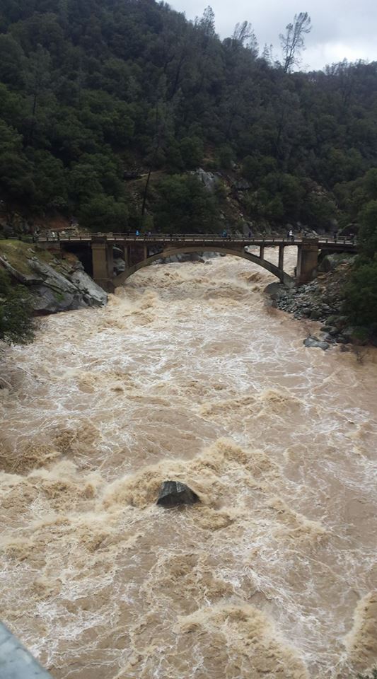
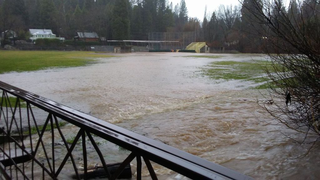
…came January. Oh, wow. Here is the difference a week made. Chula at the old 49 bridge before the January storm, and Sharon in almost the same spot, during the storm.
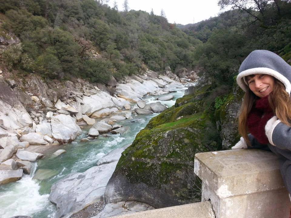
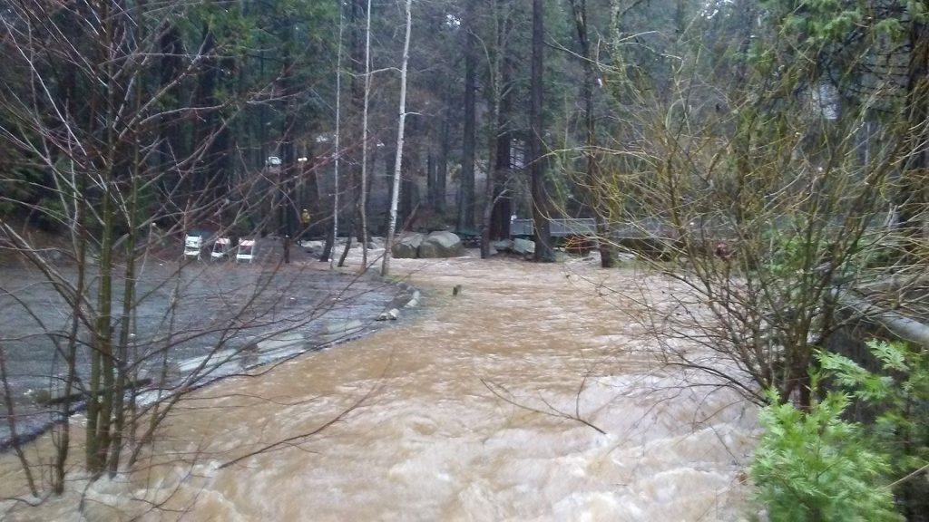
My house is 15 minutes from this crossing, and although a seasonal creek runs below it, it’s far enough away not to be dangerous, even when it rises, as it certainly did. But nothing like the Yuba.
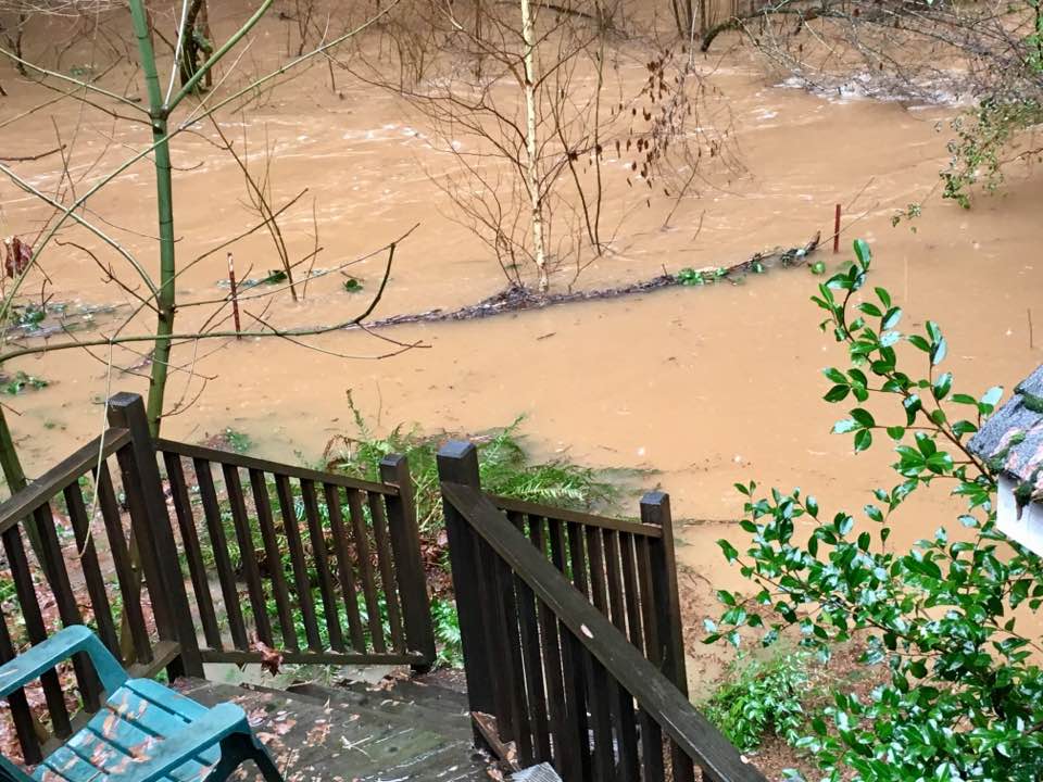
Much of Nevada City is built on a series of hills, but there are famous problem areas, such as this restaurant at the confluence of Deer Creek and Little Deer Creek. In my time it’s been Kirby’s Creekside, Amigos, and now Lefty’s Grill.
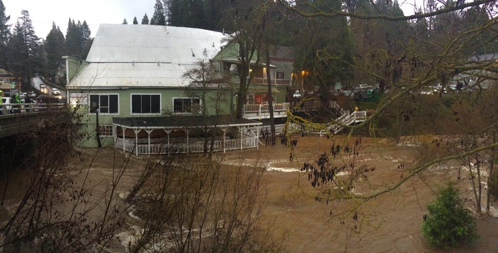
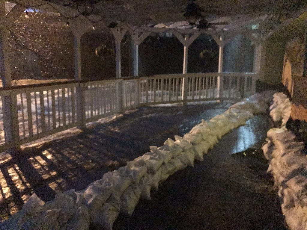
My coaching office is across the street from Lefty’s, through one parking lot, second building on the right. This sweet little creek meanders past its back door before racing through the culvert and emptying out at Lefty’s. It crept up to the third step and flooded the downstairs apartment on the creek side but did not get to our offices.
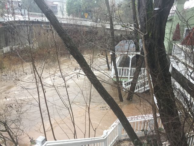
For a while the culvert held, but then we got two surprises: one was a sink hole in the parking lot…
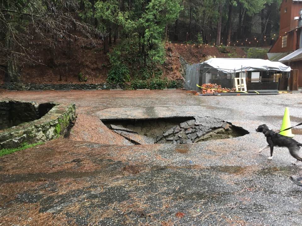
and the other was the creek taking a right turn and flooding the intersection when the culvert began backing up.
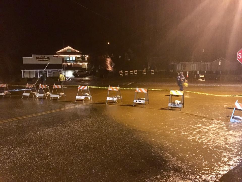
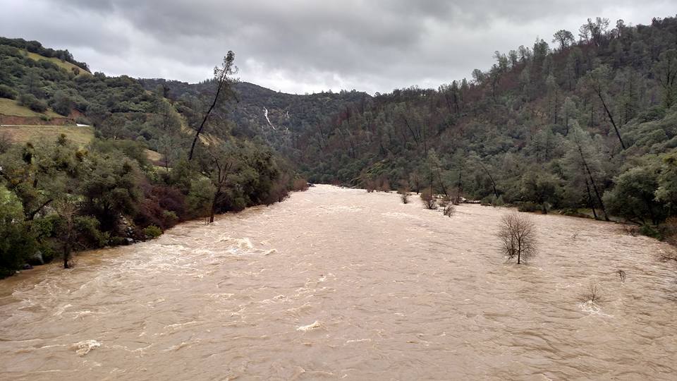
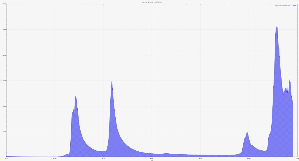
This meant that water was flowing into Lefty’s from below, as the creeks rose, and also through their front door at this street level as the intersection flooded. Here’s a scientific friend’s graph of the water levels of the South Yuba in cubic feet per second at Jones Bar. The two spikes in mid-December are 12,000 and 15,000 cfs. The small bump on January 4th is 5,000 cfs. The big one on Jan. 9th and 10th is 26,000 cfs.
NNOA is saying the drought is officially over for Northern California, which is wonderful news.
But guess what? It’s just started raining again…
What great photos! Thanks for the summary of what happened during that crazy deluge. Now I’m sitting here listening to another storm pound my roof. Time to go check the sandbags!
Thank you! We’re supposed to get slammed again tonight, but it hasn’t started yet. Hope your stove is crackling and your children are baking!
Hi Molly,
I have been thinking of you and Nevada County a lot lately. It was really good to get this from you. When I moved to Nevada County that restaurant was known as “The Jacks” and was known for it’s outstanding cuisine. With 2 more storms heading our way it is scary. So be safe, warm and continue to take great pictures and writing about life.
What do you know about Ursuela Freymuth’s passing. I just recently heard about it and am greaving. I have some of her art work which I love and could feel her presence when ever it caught my eye, now I
Look at it and miss her.
Love to you, Ruth
Hi, Ruth! I’ll send you an e-mail about Ursula. Someone else has mentioned The Jacks, but I hadn’t heard of it, being a newcomer of only 20 years residency. 😉
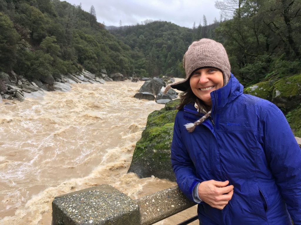
Holy cow! I note that the water in the South Yuba looks like it comes just up to a past high water mark – where boulders end and vegetation begins, and where bare rock on the big boulder ends, and moss starts covering it; and also that when we moved here, and were eating at Kirby’s Creekside a lot, we heard about a previous time that the lower deck and room had been flooded. I find it a little comforting that these water levels seem to have a precedent, though still astonishing and a bit alarming.
The problem with The Weight of the Water , the film, is the way the novel by Anita Shreve, was adapted for the screen.